- Windows
- Users' choice
- Autocad map download free
Autocad map download free
Most people looking for Autocad map free downloaded:
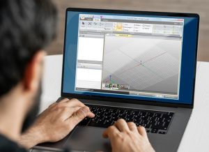
AutoCAD® Map 3D mapping software is a model-based infrastructure planning and management application that provides broad access to CAD and GIS data.
AutoCAD Map 3D is a model-based GIS and mapping software. It can be used to get broad access to CAD and GIS data ...
AutoCAD® Map 3D mapping software is a model-based infrastructure planning and management application that provides broad access to CAD and GIS data.
 Download
The Civil Object Enabler is a freeware application that you can use to access AutoCAD Civil 3D drawing files.
Download
AutoCAD Plant 3D 2013 Service Pack 2 is a free program that includes corrections that prevent potentially serious data loss.
Programs for query ″autocad map download free″
Download
Who works with GIS has often the problem of facing with files in ESRI ® Shape format, containing geometry and attributes.
...Attributes) in AutoCAD, making a ...in AutoCAD. ...compatible with AutoCAD Map 2008...
The AutoCAD® Raster Design 2010 Object Enabler is a free of charge application that you can use to display AutoCAD® Raster Design 2010 image files.
...Enabler is a free of charge ...installation. The AutoCAD® Civil 2010...
Use raster design tools in a specialized toolset to edit scanned drawings and convert raster images to DWG™ objects.
...AutoCAD, AutoCAD® Architecture, AutoCAD® Civil 3D®, AutoCAD® Electrical, AutoCAD® Map...
Download
This Hot Fix includes the fixes to a number of major defects which are found in AutoCAD Map 3D 2017 ...
...found in AutoCAD Map 3D 2017 ...for symbols, Map 3D crashing...
Make the most of raster images, maps, aerial photos, satellite imagery, and digital elevation models.
...AutoCAD, AutoCAD® Architecture, AutoCAD® Civil 3D®, AutoCAD® Electrical, AutoCAD® Map...
Download
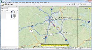
Plex.Earth is an AutoCAD plugin that allows you to use satellite imagery and terrain information from online services such as Google Maps.
...is an AutoCAD plugin that ...as Google Maps. You can ...automatically zoom Map Explorer or...
The Autodesk Building Systems Object Enabler 2007 makes Autodesk Building Systems 2007 objects come to life in AutoCAD ...
...life in AutoCAD 2007, AutoCAD Map 2007...
Download
GeoTools is an add-on program to help you boost your productivity with AutoCAD / Map and Bricscad.
...productivity with AutoCAD / Map and Bricscad ...using plain AutoCAD / Bricscad. GeoTools...
Download
Plex.Earth Tools for AutoCAD 2010-2011 is a program that gives you all the tools you need to utilize satellite imagery ...
...Tools for AutoCAD 2010-2011 ...to Bing Maps, OpenStreetMap ...automatically zoom Map Explorer or...
Download
Plex.Earth provides the tools to utilize aerial/satellite imagery and terrain data ...
...Earth/Maps, Bing Maps, OpenStreetMap ...Requires AutoCAD 2010-2017 ...Civil 3D, Map 3D ...
Interesting tutorials
...modeling applications.AutoCAD ...need to download the following ..." list. Free to use...

...need to download ...Step 1 Download and install ...download KML files from Google Maps...
...tool, like AutoCAD's DXF, seems ...need to download ...versions of AutoCAD. It...

...need to download the following...
...applications (including AutoCAD, Caddie or ...need to download ...15-day free trial that...
...need to download ...but a 5-day free trial version ...Finish" button, a map containing...
...familiar with AutoCAD, then ...need to download ...customization options Free trial...