- Windows
- Users' choice
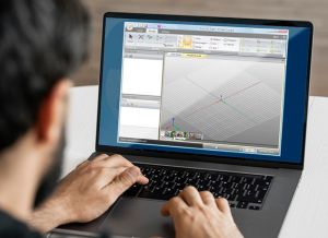
- Cad tools for autocad
Cad tools for autocad
Most people looking for Cad tools for autocad downloaded:
Programs for query ″cad tools for autocad″
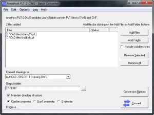
 Download
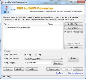
Plex.Earth Tools is the world's leading solution for incorporating aerial imagery and terrain, synchronizing and exchanging data.
Plex.Earth Tools is ...right into AutoCAD with color ...version of AutoCAD!
AutoCAD 2014 is a program that allows you to explore and visualize 3D concepts with a powerful set of intuitive design tools.
AutoCAD 2014 is a ...intuitive design tools. You can ...files from AutoCAD-based applications...
Download
Plex.Earth Tools for AutoCAD 2012-2014 is an add-on for bringing out the best in your design, importing aerial imagery and terrain elevation contours.
Plex.Earth Tools for AutoCAD 2012-2014...
Download
Plex.Earth is an AutoCAD plugin that allows you to use satellite imagery and terrain information from online services such as Google Maps.
...is an AutoCAD plugin that...
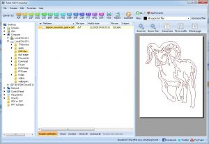
Ultra AutoCAD Tool is a program that allows you to extract data from drawing files (CSV,XML,HTML) and import to a database or Excel workbook.
Ultra AutoCAD Tool is a program...
Download
Plex.Earth Tools for AutoCAD 2010-2011 is a program that gives you all the tools you need to utilize satellite imagery ...
Plex.Earth Tools for AutoCAD 2010-2011 ...all the tools you need...
AutoCAD 2012 VBA Enabler is an useful tool for your autocad software.
AutoCAD 2012 VBA ...useful tool for your autocad software ...download for Autocad 2012 product...
Use raster design tools in a specialized toolset to edit scanned drawings and convert raster images to DWG™ objects.
...vector conversion tools, AutoCAD® Raster Design...
Download
GeoTools is an add-on program to help you boost your productivity with AutoCAD / Map and Bricscad.
...productivity with AutoCAD / Map ...using plain AutoCAD / Bricscad ...just any AutoCAD user.
Download
Plex.Earth provides the tools to utilize aerial/satellite imagery and terrain data ...
...provides the tools to utilize ...images. Requires AutoCAD 2010-2017...
Interesting tutorials
...applications.AutoCAD ...CAD (Computer-Aided Design) tool ...viewing AutoCAD designs...
...AutoCAD and various other CAD ...that this tool comes with ...check the tools from...
...CAD (Computer-Aided Design) tool, like AutoCAD ...desired AutoCAD ...of AutoCAD. It...
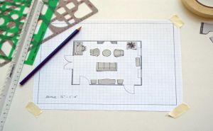
...house planning tools, it provides ...select a drawing tool. You can ...interior design tools will...
...popular AutoCAD ...between AutoCAD and other CAD& ...almost all CAD tools, can come...
...(including AutoCAD, Caddie or ...task using CAD software ...an alternative tool , then...
...design software, AutoCAD, then you ...them using CAD software ...a great conversion tool by many...