- Windows
- Users' choice
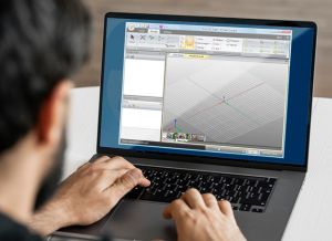
- Autodesk land development software
Autodesk land development software
Most people looking for Autodesk land development software downloaded:
This 2.01 service pack installs the latest updates to AutoCAD Land Development Desktop R2.
Autodesk has released Autodesk® Land Desktop 2005 Service Pack 1, which addresses several known issues with Autodesk Land Desktop 2005.
Concept Design & Illustration Software Explore design concepts and produce stunning artwork with Autodesk® SketchBook® Designer illustration software.
This plug-in can be used with AutoCAD to simplify the process of managing apps installed from Exchange.
Programs for query ″autodesk land development software″
 Download
Use the ObjectARX® programming environment to customize and extend AutoCAD and AutoCAD-based products with direct ...
...interfaces for developers to ...AutoCAD software and ...and AutoCAD® Land Desktop software.
Autodesk® LandXplorer™ Xpress Viewer software is a free* downloadable program to view city models created in Autodesk® LandXplorer™ Studio Professional software.
Autodesk® LandXplorer™ Xpress Viewer software is a free...
Download
In a continuing effort to provide high quality products, Autodesk has released Autodesk® Civil Design 2005 Service Pack ...
...products, Autodesk has released Autodesk® ...as Autodesk® Land Desktop 2004, Autodesk® Land...
Download
Autodesk LandXplorer CityGML Viewer Autodesk LandXplorer CityGML Viewer software is a free downloadable program to view CityGML data sets.
...Viewer Autodesk LandXplorer CityGML Viewer software...
With the Autodesk Network Installation Wizard patch, you can use the Network Installation wizard to apply a service ...
...Autodesk MapTM 2004 - Autodesk Mechanical ...Autodesk Building Systems 2004 - Autodesk Land...
Download
Carlson Connect is a collection of routines for transferring and converting data between Autodesk Land Desktop ...
...between Autodesk Land Desktop or Autodesk Civil ...collection software. Carlson Software has...
Download
Using these Bridge Modeling Autodesk Revit Extensions, you can generate bridges based on user-defined criteria.
...Bridge Modeling Autodesk Revit Extensions...
A simple design tool for smart ideas. It's easy to use, low-cost 2D drawing program ideal for creating ...
...office productivity software, AutoCAD Freestyle...
GroundCAD is a 2D CAD free software for the land surveying and civil engineering.
...free software for the land surveying ...(txt/csv), Autodesk dxf(ascii...
Download
LS-CON Lite is an addon for AutoCAD Civil 3D, which provides 20 artistic landscape blocks.
...restart the Autodesk product to...
Interesting tutorials
...famous Autodesk 3ds ...install additional software (adware). ...function of Autodesk 3ds...
... Autodesk Inventor (a software for ...from Autodesk Inventor ...following software to...

...). Its latest software development kit (SDK ...engine, VR development solutions, multiplayer...
...Autodesk's famous computer-aided design software ...CAD software, as ...by AnyDWG Software, Inc...

...drawing software This ...Inkscape, Autodesk SketchBook Pro ...technical drawing software that's...
...in web development. One thing ...piece of software, because ...install additional software. You...
...by CoolUtils Development, because it ...the following software to ...the related software list...